- Log in
-
- Sydney Overseas Office
- London Overseas Office
- Paris Overseas Office
- Toronto Overseas Office
- Los Angeles Overseas Office
- New York Overseas Office
- Ulaanbaatar Overseas Office
- Istanbul Overseas Office
- Dubai Overseas Office
- New Delhi Overseas Office
- Manila Overseas Office
- Jakarta Overseas Office
- Hanoi Overseas Office
- Kuala Lumpur Overseas Office
- Singapore Overseas Office
- Bangkok Overseas Office
- Map
- Sydney Overseas Office
- London Overseas Office
- Paris Overseas Office
- Toronto Overseas Office
- Los Angeles Overseas Office
- New York Overseas Office
- Ulaanbaatar Overseas Office
- Istanbul Overseas Office
- Dubai Overseas Office
- New Delhi Overseas Office
- Manila Overseas Office
- Jakarta Overseas Office
- Hanoi Overseas Office
- Kuala Lumpur Overseas Office
- Singapore Overseas Office
- Bangkok Overseas Office
Travel Highlights
-
-
-
Five Hiking Courses in Seoul for All Skill Levels
-
08/07/2023
8.4K
-
0
2
-
-
nature
valley
hiking
wild_ingredients
autumn
-
-
-

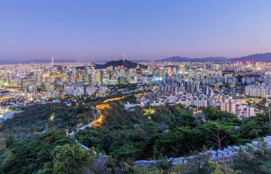
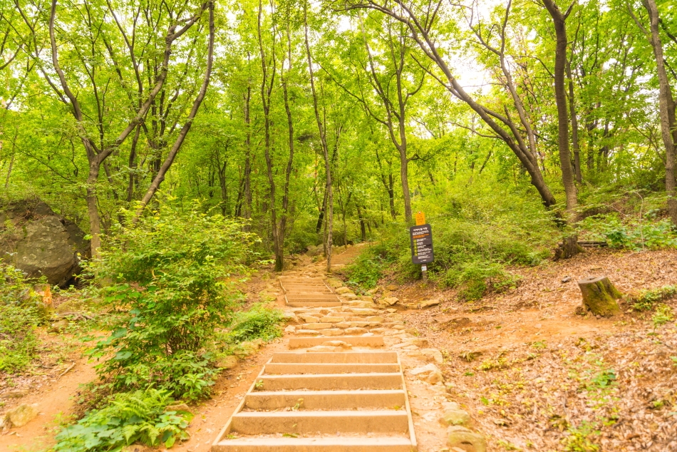
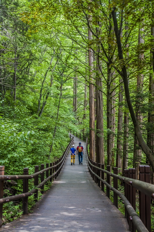
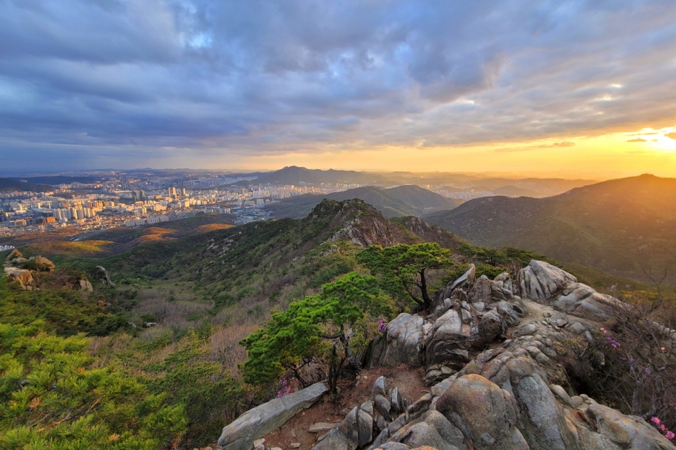
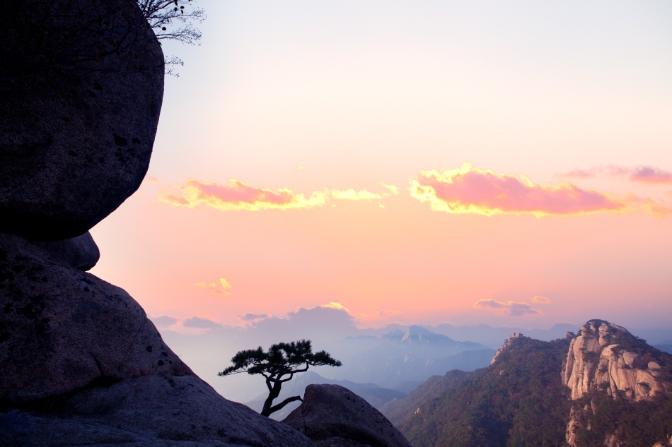
Seoul isn’t just home to millions of people, it’s also home to many mountains both large and small. Everywhere you look, the skyline of Seoul’s tall buildings is backed by undulating mountain ridges. From the peaks of these mountains, you can see the whole of Seoul unfold before you.
The mountains around Seoul have an average height of 410 meters, making them quite low and easy for hikers of all skill levels. The mountains are also the perfect place to enjoy Korea’s changing seasons. Especially in summer, you can enjoy the cool breeze that blows through the shaded valleys. Another attraction of the mountains is how easily accessible they are via Seoul’s extensive public transit system, with most hiking paths starting just a short walk from subway station exits. To enjoy a bird’s-eye-view of Seoul while in peaceful nature, select one of the courses below, available in various difficulty levels.
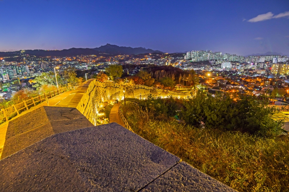
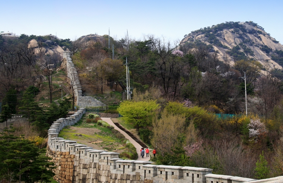
1. Hanyangdoseong, Seoul City Wall (Naksan Section 2.1 km) | Walk through History
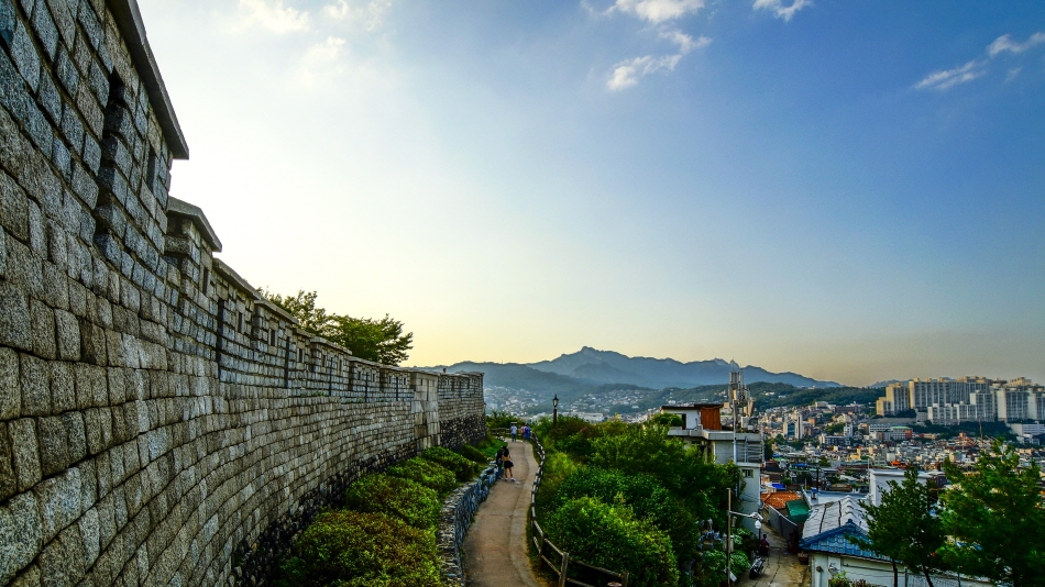
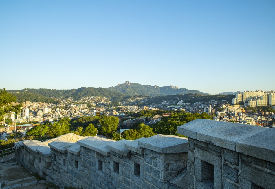
Hanyangdoseong, the Seoul City Wall, was built in 1396 to protect Hanseong, the then-capital city of Joseon. Currently, the old city wall in located in the middle of Seoul, and is divided into six sections. Among these, the Naksan Section is the easiest course, and offers stunning nightscape views, making it a popular choice. You can receive a commemorative badge if you walk all six sections of Hanyangdoseong and collect stamps at the designated spots.
* Hanyangdoseong Stamp Tour
- 1. Pick up a stamp tour map at one of the designated locations (Donuimun Museum Village Information Center, Heunginjimun Gate Maintenance Office, Sungnyemun Gate, Malbawi Rock Information Center).
- 2. While walking the Hanyangdoseong, collect stamps on your map at the stamp locations.
- 3. Take pictures at the indicated locations (Cheongundae Monument, Naksan Mountain summit, Site of Beacons on Mongmyeoksan Mountain, Inwangsan Mountain summit).
- 4. Download the application form from the Hanyangdoseong website (seoulcitywall.seoul.go.kr) and e-mail the completed form to [email protected].
- 5. Submit your completed stamp tour map and photos to Hanyang Doseong Historic Site Museum or Hyehwa-dong Exhibition & Information Center for final approval to receive your commemorative badge.
- Directions: Walk from Hansung Univ. Station (Seoul Subway Line 4), Exit 4
- Recommended course (Naksan Section): Hyehwamun Gate – Naksan Park – Cultural Plaza – Ehwa Village – Heunginjimun Gate
- Required time: 1 hr
- Difficulty: ★★☆☆☆Hanyangdoseong Courses
- ① Sungnyemun Section (1 hr fege 1.8 km, ★☆☆☆☆) Baekbeom Plaza – Namdaemun Market – Sungnyemun Gate – Site of Donuimun Gate & Kangbuk Samsung Medical Center / Start from Hoehyeon Station (Seoul Subway Line 4), Exit 5
- ② Heunginjimun Section (1 hr / 1.8 km, ★☆☆☆☆) Heunginjimun Gate – Dongdaemun History & Culture Park (Previous Site of Dongdaemun Stadium) – Gwanghuimun Gate – Jangchung Gymnasium / Start from Dongdaemun Station (Seoul Subway Line 1, 4), Exit 6 or 7
- ③ Namsan Section (3 hr / 4.2 km, ★★★☆☆) Jangchung Gymnasium – National Theater of Korea – N Seoul Tower – Namsan Octagonal Pavilion – Baekbeom Plaza / Start from Dongguk Univ. Station (Seoul Subway Line 3), Exit 5
- ④ Baegak Section (3 hr / 4.7 km, ★★★★★) Changuimun Gate – Sukjeongmun Gate – Malbawi Rock Information Center – Waryong Park –Hyehwamun Gate / From Gyeongbukgung Station (Seoul Subway Line 3), Exit 3, take Bus No. 7212, 1020, 7022 to Jahamungogae, Yun Dongju Hill Bus Stop
- ⑤ Inwangsan Section (2 hr 30 min / 4 km, ★★★★★) Site of Donuimun Gate – Inwangsan Mountain summit – Yun Dongju Hill – Changuimun Gate / Start from Seodaemun Station (Seoul Subway Line 5), Exit 4
2. Inwangsan Mountain (338.2 m) | Panoramic view of Seoul
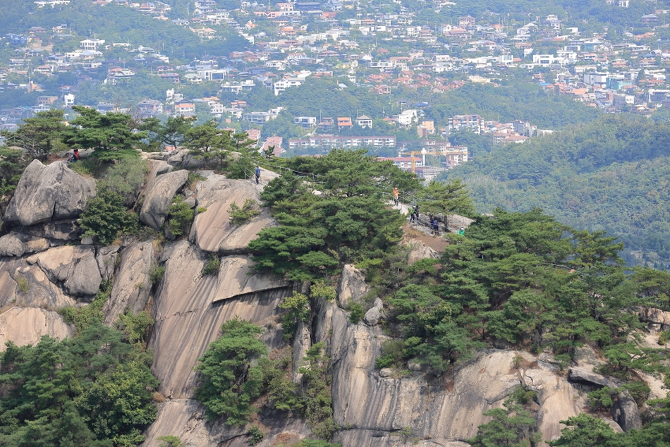
Standing atop Inwangsan Mountain is like standing in the middle of Seoul due to its location in Jongno-gu, near the center of the city. The hiking trail even starts from the middle of the city, near Gyeongbokgung Station! The path is well maintained, and is short enough that even the most inexperienced hiker can reach the summit in no time. If you’re visiting with young children or someone who has walking difficulties, the Inwangsan Jarak Trail (2.5 km / 1 hr) that circles the mountain is a great choice.
- Directions: Walk from Gyeongbokgung Station (Seoul Subway Line 3), Exit 1
- Recommended course: Gyeongbokgung Station – Inwangsan Jarak Trail – Beombawi Rock –Inwangsan Mountain summit
- Required time: Round-trip 2 hr 30 min
- Difficulty: ★☆☆☆☆3. Cheonggyesan Mountain (618 m) | Stairway to Heaven
Cheonggyesan Mountain is jokingly called “cheongaesan,” a Korean play on words in reference to the thousand (“cheon gae”) stairs you must climb to reach the summit. While there aren’t actually one thousand stairs, the mountain does seem to have an endless supply of them.
Kkalddakgogae Pass in particular was named for the sharp sound of breathing you’ll produce after climbing up the steep staircase here. But if you can make it past that section, the summit will be just before you. During the summer months when it rains often, the sound of water babbling in the valley brook will keep you company.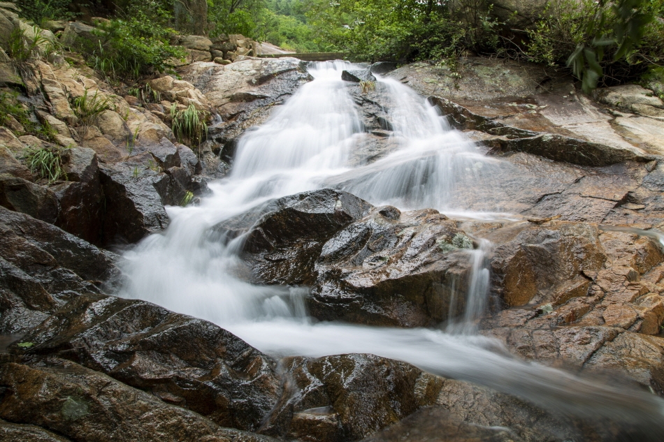
- Directions: Walk from Cheonggyesan Station (Seoul Subway Sinbundang Line), Exit 2
- Recommended course: Wonteogol Entrance – Wonteogol Mineral Spring – Kkalddakgogae Pass – Helipad – Maebong Peak
- Required time: Round-trip 3 hr
- Difficulty: ★★☆☆☆4. Gwanaksan Mountain (632 m) | Path of many ups and downs
Gwanaksan Mountain isn’t that large in the grand scale of mountains, but it is quite a strenuous hike, requiring adequate warm-up before starting out. You’ll also want to be equipped with proper hiking boots. The trail begins with a rather flat walk, but quickly leads to repeated ups and downs as you follow the ridge line of this rocky mountain. Preparing gloves or hiking sticks can make your walk easier. If you enjoy an active lifestyle, you may even come to enjoy the roller-coaster-like walk.

- Directions: Walk from Sadang Station (Seoul Subway Line 2), Exit 4
- Recommended course: Gwaneumsa Temple – Madangbawi Rock – Gwanakmun Gate – Gwanaksan Mountain summit – Kkalddakgogae Pass – Seoul National Univ. Engineering Building 2
- Required time: Round-trip 4 hr
- Difficulty: ★★★☆☆5. Dobongsan Mountain (740 m) | Beautiful stone peaks
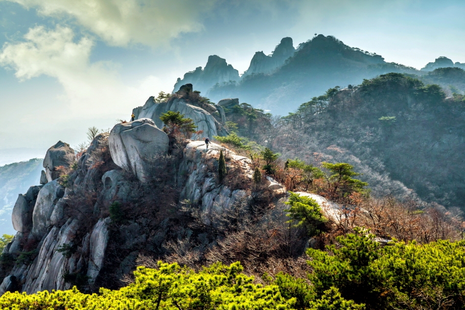
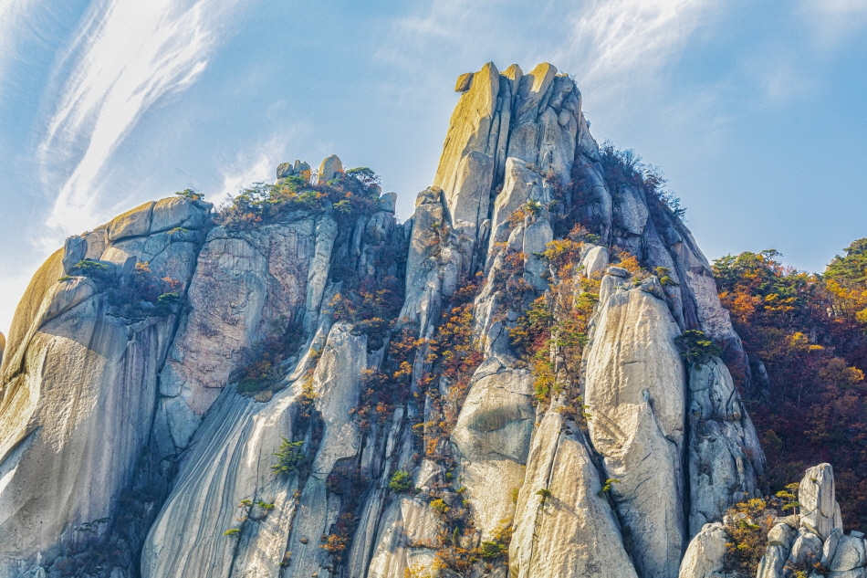
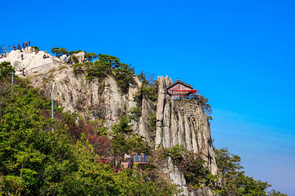
Dobongsan Mountain is located on Seoul’s northern side, bordering Uijeongbu and Yangju in Gyeonggi-do. The mountain stands out for its many rocky peaks, ranging from softly rounded to sharp points. While the mountain is smaller than Bukhansan Mountain, the rocky terrain makes it a much more difficult hike. Despite this, hikers often say the hardships at reaching the summit are all but forgotten when they take in the view from the majestic rocky peaks.
- Directions: Walk from Dobongsan Station (Seoul Subway Line 1), Exit 1
- Recommended course: Dobong Control Station – Bomunneungseon Ridge – Dobongjuneungseon Ridge – Podaeneungseon Ridge – Sapaeneungseon Ridge – Sapaesan Mountain – Angol Control Station (9.8 km course)
- Required time: Round-trip 5 hr
- Difficulty: ★★★★★Practice Hiking Safety
- - Select a course that matches your skill level
- - Check the weather report for your planned area in advance
- - Do some warm-up exercises before hiking
- - Stay on the designated paths
- - Do not pick or eat any wild plants or mushrooms
- - Descend slowly to protect your knees and ankles
Hiking Apps for Safety
- - Korea National Parks Service – National Park Hiking Information app (Korean only)
Google Play
The App Store - - Emergency Notice App (Korean only)
Google Play
The App Store
More info
- 1330 Korea Travel Helpline: +82-2-1330 (Korean, English, Japanese, Chinese, Russian, Vietnamese, Thai, Malay)
* This column was last updated in June 2023, and therefore information may differ from what is presented here. We advise you to check for updates before visiting.
-

1330 Helpline Call/Chat

Start a FREE Online Call(No charges for calls on Wi-Fi /
Data charges may apply)

Open 1330 Helpline Chat(Download not required)