- Log in
-
- Sydney Overseas Office
- London Overseas Office
- Toronto Overseas Office
- Los Angeles Overseas Office
- New York Overseas Office
- Ulaanbaatar Overseas Office
- Dubai Overseas Office
- New Delhi Overseas Office
- Manila Overseas Office
- Jakarta Overseas Office
- Hanoi Overseas Office
- Kuala Lumpur Overseas Office
- Singapore Overseas Office
- Bangkok Overseas Office
- Map
- Sydney Overseas Office
- London Overseas Office
- Toronto Overseas Office
- Los Angeles Overseas Office
- New York Overseas Office
- Ulaanbaatar Overseas Office
- Dubai Overseas Office
- New Delhi Overseas Office
- Manila Overseas Office
- Jakarta Overseas Office
- Hanoi Overseas Office
- Kuala Lumpur Overseas Office
- Singapore Overseas Office
- Bangkok Overseas Office
- HOME
- Where to Go
- Destinations
-
-
-
Deogyusan National Park (Main, Jeoksang Section) (덕유산국립공원 (본소,적상분소))
-
9
6
-
-
-
-
![]()
![]()
![]()
![]()
![]()
![]()
![]()
![]()
![]()
![]()
![]()
![]()
![]()
![]()
![]()
![]()
![]()
![]()
![]()
![]()
![]()
![]()
![]()
![]()
![]()
![]()
![]()
![]()
![]()
![]()
![]()
![]()
![]()
![]()
![]()
![]()
![]()
![]()
![]()
![]()
![]()
![]()
![]()
![]()
![]()
![]()
![]()
![]()
![]()
![]() 1 / 50
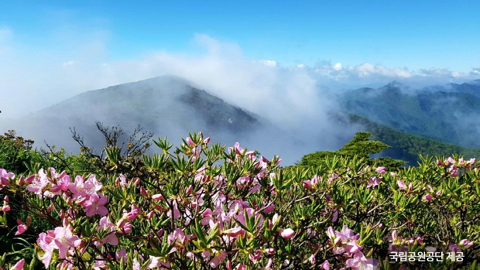
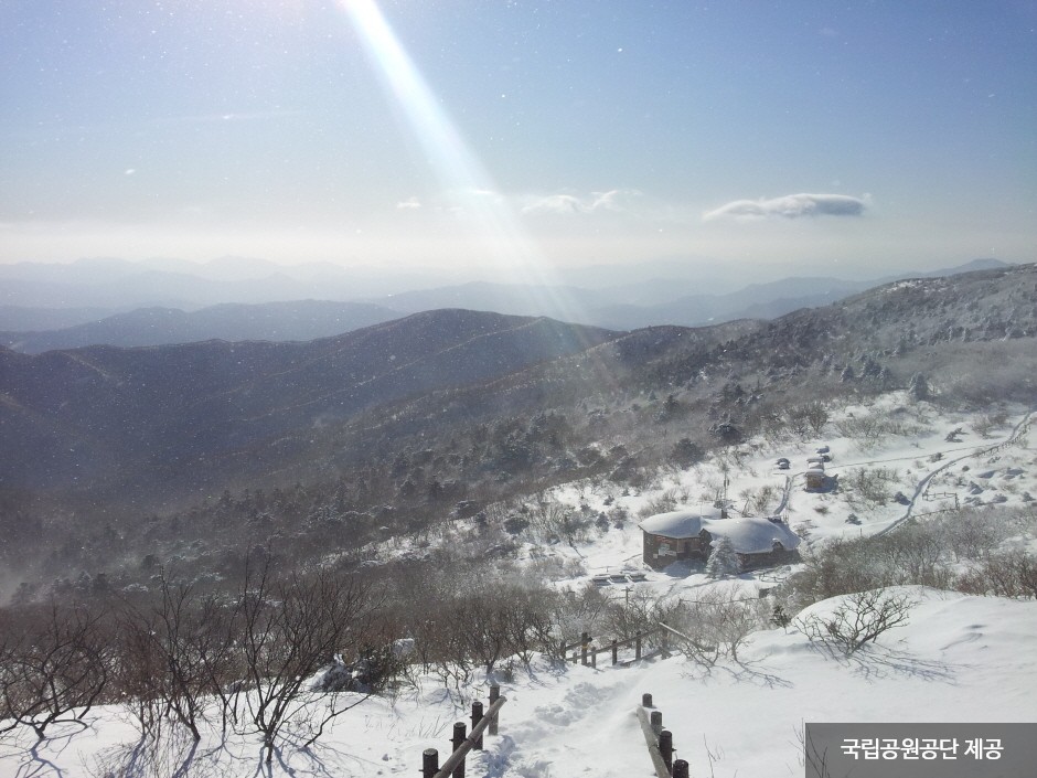
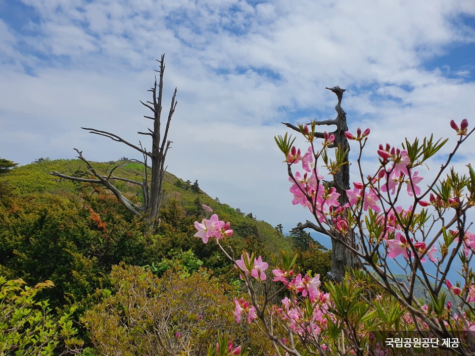
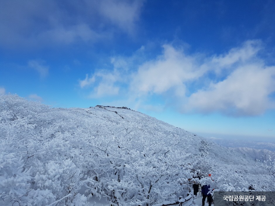
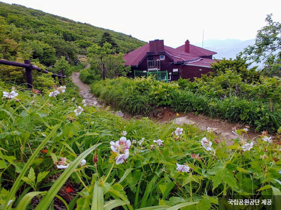
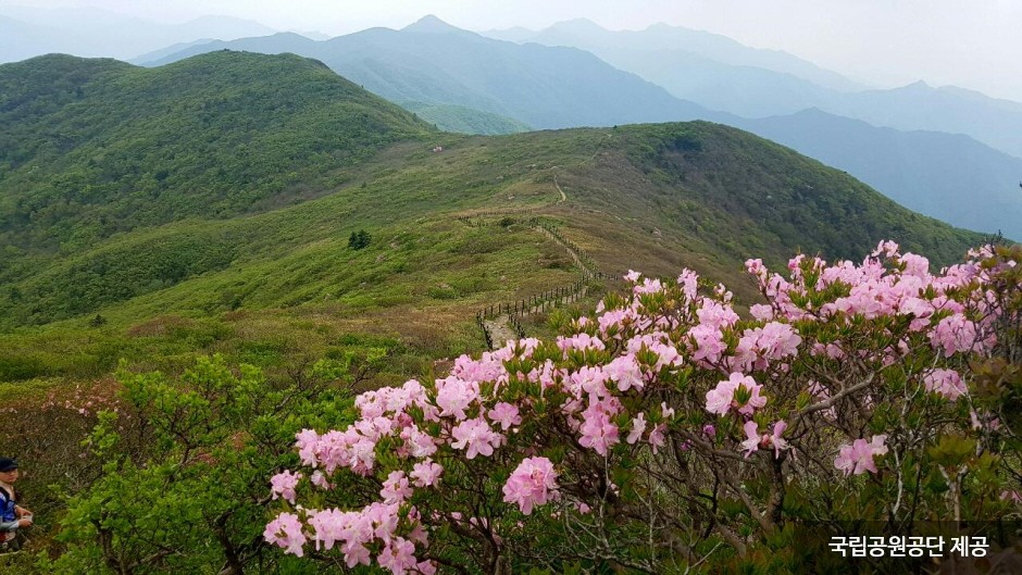
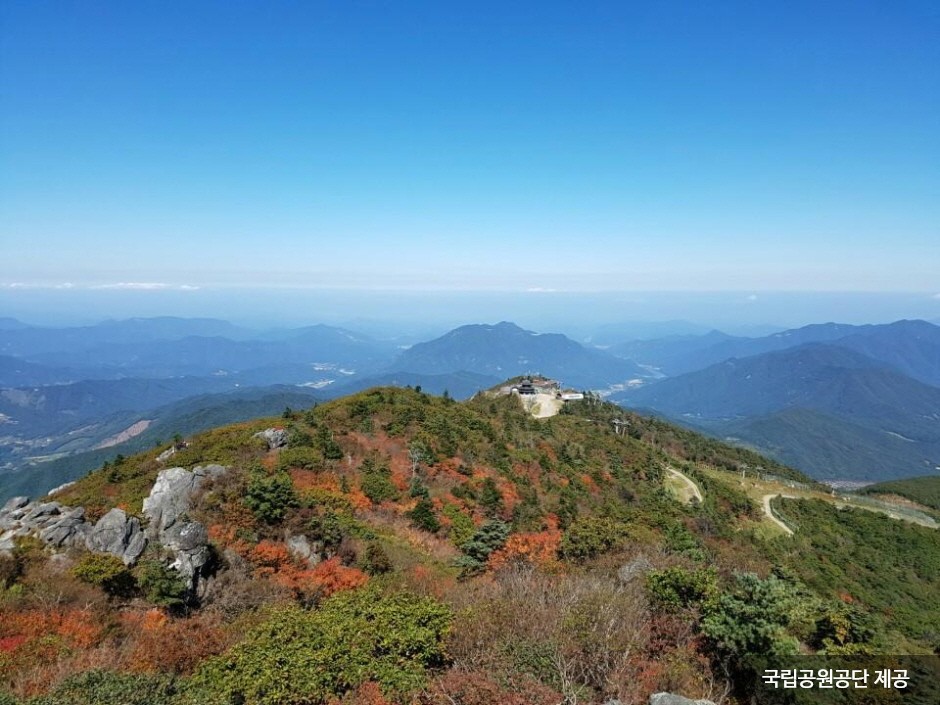
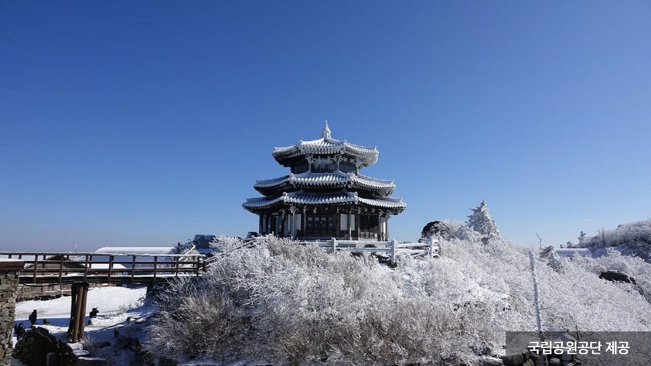
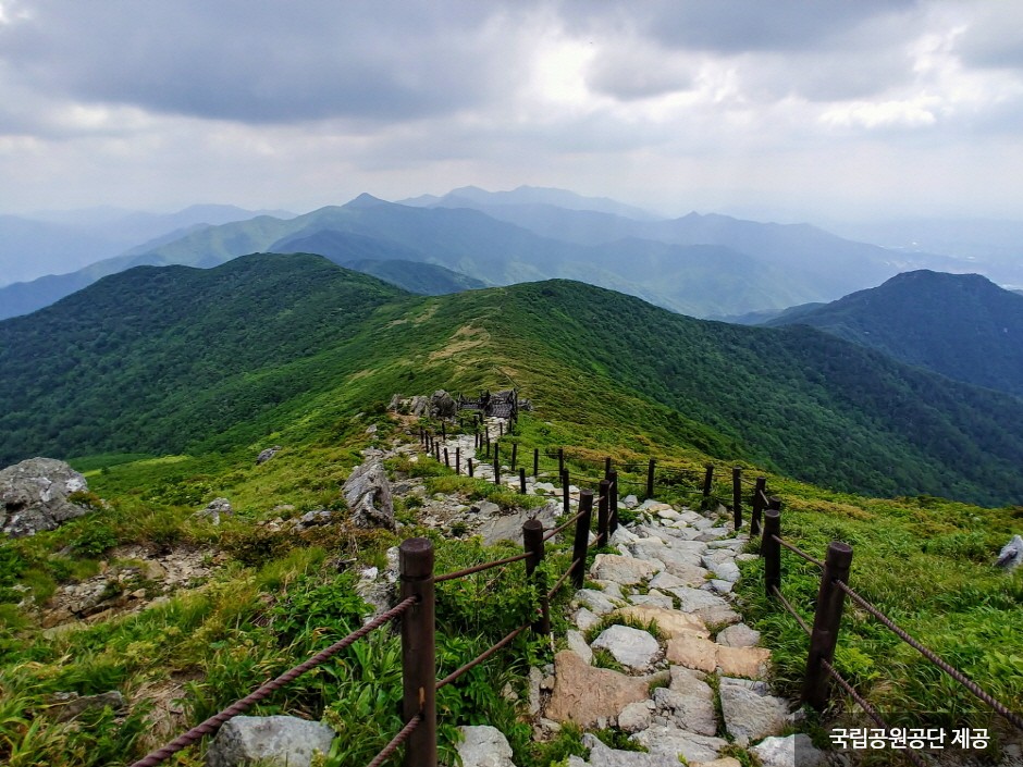
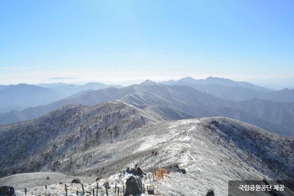
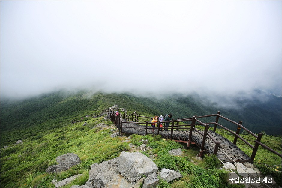
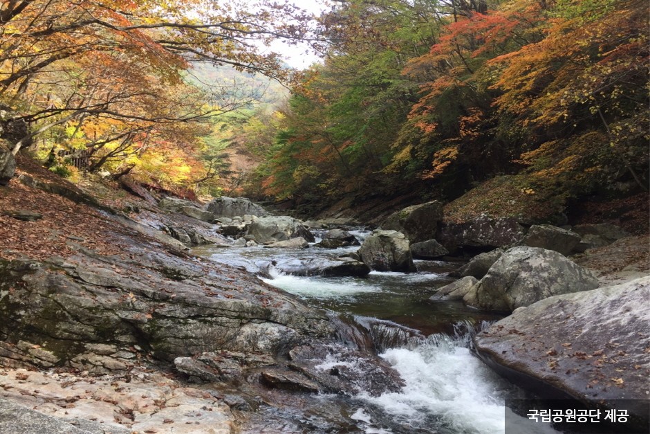
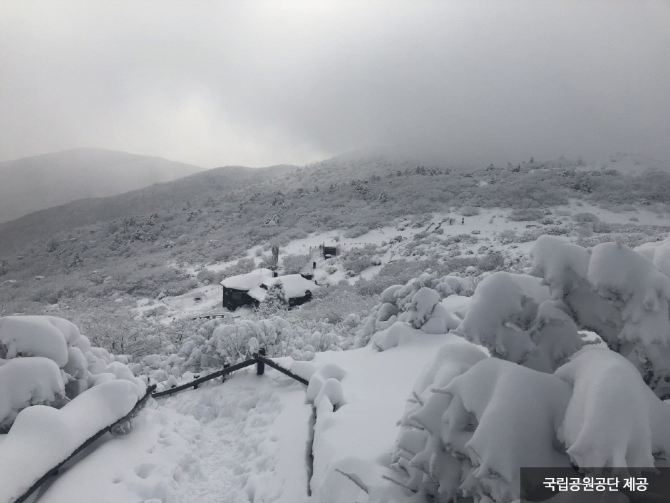
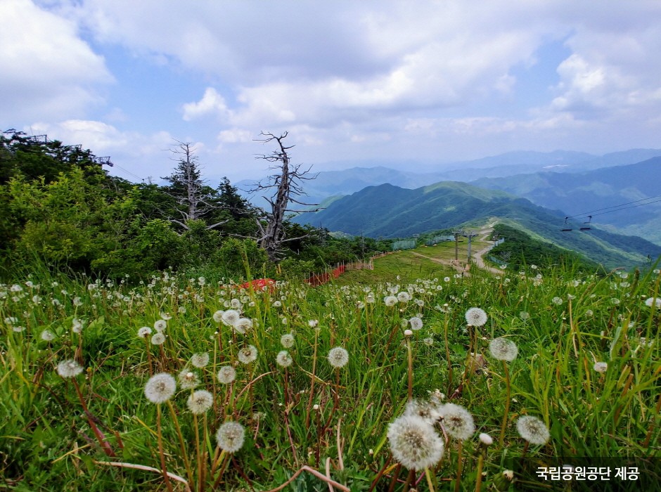
1 / 50The area of Deogyusan National Park stretches out from the southern ridges of Sobaeksan Mountain, covering regions within four different counties in Gyeongsangnam-do and Jeollabuk-do. The park is nestled in Deogyusan Mountain, Korea's 4th tallest mountain with the summit reaching an elevation of 1,614 meters. The mountain is blessed with a 36-kilometer valley dotted with several scenic points, ponds, and waterfalls.
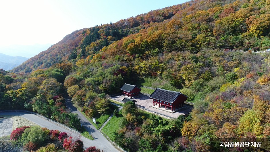
The mountain contains prestigious cultural heritages, such as Jeoksangsanseong Fortress (Historic Site No. 146) and the Hanging Painting of Anguksa Temple (Treasure No. 1267) to name a few. It is also home to diverse wildlife animals and plants. The mountain's beauty can be enjoyed all year round, with royal azaleas in spring, a colony of daylilies in summer, colorful autumn foliage in fall, and a white snowy mountain vista in winter.
What's nearby Here are some recommended destinations nearby! Attractions within 50 kilometers are arranged in the order of closest distance.Map Directions


Start a FREE Online Call
(No charges for calls on Wi-Fi /
Data charges may apply)

Open 1330 Helpline Chat(Download not required)